
Kesowa Reimagines India’s Mapping Landscape Through CORS
We’re elated to share that Kesowa has once again been featured in the Association of Geospatial Industries’ (AGI) quarterly newsletter, this time in the April 2025 edition.
THOUGHT-PAPERCHANNEL-PARTNER
Rimashree
7/31/20252 min read

From Digital Twins to Dynamic Earth: Kesowa's Evolution
In January, AGI highlighted our pioneering work in Digital Twin technology. This time, Kesowa is being recognized for breaking new ground in how CORS (Continuously Operating Reference Stations) can be used to detect and map ground movement—a crucial, often overlooked factor in everything from land disputes to disaster preparedness.
Our article, titled “Using CORS Technology to Detect and Measure Ground Movement,” explores how centimeter-level precision data can change the game for land records and seismic monitoring. It's not just about pretty maps anymore—it’s about living maps that reflect the earth’s subtle shifts in real time.
Why CORS?
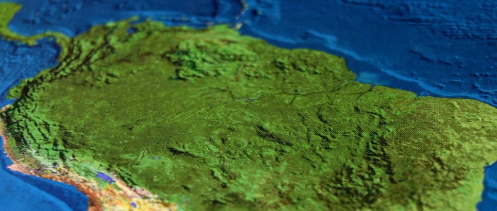
CORS networks are the silent sentinels of geospatial accuracy. Think GPS, but supercharged. These permanent stations track satellite signals 24/7, offering hyper-accurate positional data that reveals even the tiniest tremors beneath our feet.
Kesowa’s work focuses on leveraging this technology to solve real-world challenges like:
Land boundary mismatches caused by tectonic shifts or subsidence.
Early warning systems for earthquakes, landslides, and infrastructure instability.
Infrastructure safety monitoring for critical sites like bridges, dams, and hospitals.
Imagine a system that can detect the land beneath a highway shifting 3.2 cm eastward and alert engineers before a crack even appears.
Empowering Solutions Through CORS
Empowering Land Records Departments to maintain accurate, living cadastral maps—reducing disputes, improving governance, and streamlining urban and rural planning.
Equipping Disaster Management Agencies to deploy early-warning protocols by monitoring ground movement in high-risk zones like the Himalayas or coastal Maharashtra.
Supporting urban planners and civil engineers to make smarter, safer design decisions using near real-time ground data.
India’s Earth is Moving—We’re Tracking It
It’s not just a tech flex—it’s a public good. With India's expanding CORS network and increasing investment in geospatial infrastructure, Kesowa’s solutions are more relevant than ever. From correcting land ownership records in West Bengal to safeguarding critical infrastructure in Uttarakhand, we’re ensuring that the future is built on rock-solid, real-time intelligence.
Gratitude & Vision Ahead
We thank AGI for recognizing our work once again. It’s an honour to be part of the narrative shaping India’s geospatial evolution. And to our partners, team, and supporters—you’re the engine behind every innovation we push forward. We’re excited about solving real-world problems with CORS—while we haven’t implemented it yet, it’s firmly on our roadmap. If you’re building in this space, let’s connect.
At Kesowa, we don’t just map the world. We listen to it move.
Stay tuned as we continue to push the boundaries of what’s possible with CORS, digital twins, and geospatial intelligence.
Want to collaborate with us or learn more?
Let’s connect at sales@kesowa.in
Photo by Pixabay
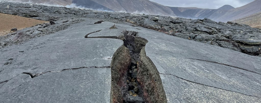
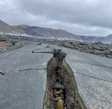
Photo by R Ewing


Helpful Links
Join Us Online
Want to learn more?
Copyright © Kesowa Infinite Ventures Private Limited
Subscribe to our newsletter for the latest features and updates.
By subscribing, you consent to our Privacy Policy and receive updates.