
Interactive Guide: See How a Drone Data Call Center Fits into Your Land Survey Workflow
What if your next land survey didn’t involve weeks of manual labor, piles of paperwork, or field crews wading through rough terrain? Enter Kesowa’s Drone Data Call Center — your smart shortcut to high-precision, lightning-fast, and collaborative land surveys.
THOUGHT-PAPERUSE-CASE
Rimashree
8/16/20255 min read


What Is a Drone Data Call Center?
A drone data call center acts as a centralized, often cloud-based, platform where all drone survey data is uploaded, processed, and made accessible to stakeholders. This hub enables real-time collaboration, rapid data turnaround, and streamlined communication between field teams, data analysts, and project managers.
Let’s walk through how a Drone Data Call Center integrates into your land survey process, step by step
Step 1: Define the Survey Scope
Start with the land size, terrain complexity, required data accuracy, and turnaround time. Once the specs are in, the Drone Data Call Center designs the optimal flight plan — high-res, geo-tagged, and regulation-ready.
Step 2: Deploy the Drones
Surveyors plan drone flights using specialized software, ensuring coverage of the target area with high accuracy.
Drones equipped with high-resolution cameras and sensors capture aerial images and geospatial data. This process is much faster and safer than traditional ground-based methods.
Step 3: Data Streaming & Processing
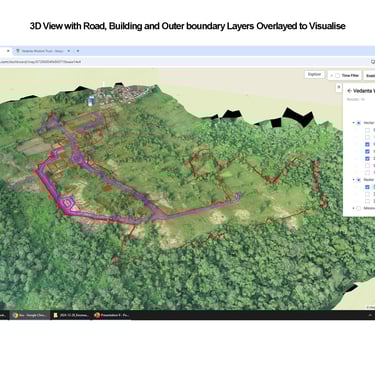
Advanced photogrammetry and mapping software within the call center processes the raw images into orthomosaics, 3D models, and topographic maps.
Cloud-based processing eliminates the need for powerful local hardware, speeding up turnaround times and reducing IT complexity.
4. Quality Control and Analysis
Data analysts review outputs for accuracy, leveraging ground control points and automated quality checks.
The call center enables real-time feedback and flagging of issues, ensuring only reliable data is passed on to the next stage.
5. Collaboration and Data Distribution
Stakeholders access processed data through the call center’s platform, which supports sharing annotated maps, 3D models, and reports with a single click.
Project managers, engineers, and clients can view, comment, and collaborate on the latest data, keeping everyone aligned and informed.
6. Integration with GIS and Project Management Tools
Final deliverables are exported in formats compatible with CAD, GIS, and other project management software, streamlining integration into existing workflow.
The call center maintains a single source of truth, ensuring version control and easy access to historical data.
Traditional vs. Modern: The Land Survey Workflow Reimagined
Land surveying has always been a precision game — but the way we get that precision has evolved radically. Let’s break down how Kesowa’s Drone Data Call Center completely rewires the old system.
Aspect
Traditional Survey Workflow
Field Work
Time
Access
Accuracy
Data Processing
Deliverables
Client Transparency
Scalability
Cost
High — due to equipment, labor, and long timelines
Prone to human error, dependent on technician skill
Limited by terrain, weather, and manpower
Manual measurement, theodolites, total stations, GCP setup
6–8 weeks from planning to deliverables
In-house bottlenecks, costly software, training overhead
Minimal visibility during data collection & processing
Difficult to scale quickly across multiple sites
Manual drafting, variable quality
Drone-Enhanced Workflow with Kesowa
1 week or less, from drone flight to ready-to-use files
1–2 hour drone flight with automated pathing and live data capture
Real-time updates, interactive portals, and transparent QC stages
Easily handles multiple missions simultaneously via Drone Call Center
Lower — optimized staff usage, fewer site visits, and faster turnaround
Standardized, CAD/GIS-ready orthomosaics, DEMs, and volume reports
Centralized call center processing using high-performance computing
AI-assisted photogrammetry with GCP correction ensures centimetre-grade precision
Aerial surveys cover large and inaccessible areas with ease
Key Benefits of Integrating a Drone Data Call Center
Speed: Data is processed and available within hours, not days or weeks.
Collaboration: All stakeholders work from the same up-to-date information, improving decision-making and accountability.
Accuracy: Automated processing and quality control reduce human error and deliver high-precision results.
Scalability: Surveyors can take on more projects simultaneously, as the call center handles heavy data workloads.
Safety: Field teams spend less time in hazardous environments, as drones handle data collection remotely.

Real-World Use Cases: Drone Data Call Center in Action
From industrial land assessments to government infrastructure audits, Kesowa’s drone-based workflow is already proving its value across India. Here’s a look at some key projects where our Drone Data Call Center reshaped the survey experience:
As-Is Factory Survey – Khardaha, Kolkata
Client: Calcutta Silk Manufacturing Co. Ltd
Challenge: Outdated or missing master plans made it difficult to understand the current condition of a closed industrial property.
Drone-Powered Solution:
Kesowa conducted a drone-based orthomosaic and digital elevation survey, overlaying AutoCAD drawings to give a crystal-clear “as-is” snapshot. This helped stakeholders — architects, developers, and financiers — strategize asset reuse with confidence.Land Boundary Conflict Resolution – Budge Budge, South 24 Parganas
Client: Indian Oil Dealer
Challenge: A two-decade-old boundary dispute due to the absence of digital land records.
Drone-Powered Solution:
High-resolution aerial mapping enabled the superimposition of digitized mouza maps, resolving discrepancies and paving the way for legal and commercial resolution.Progress Monitoring – Water Treatment Plant, Newtown
Client: WB Public Health Engineering Directorate
Challenge: Site status was unclear, and field complaints required frequent on-ground verification.
Drone-Powered Solution:
Through time-stamped drone surveys, Kesowa generated detailed intelligence reports that aligned construction progress with contractor billing and site expectations — streamlining oversight.City-Wide Aerial Intelligence – Newtown Kolkata Development Authority
Client: NKDA
Challenge: Need for consistent urban oversight: auditing contractors, resolving tax disputes, and monitoring development.
Drone-Powered Solution:
Kesowa established a dedicated Drone Data Call Center that now serves as a centralized hub for maps, site videos, and reports — powering decision-making at scale for an entire township.Utility Asset Survey – CESC Transmission Lines
Client: CESC Ltd.
Challenge: Structural issues, overgrown vegetation, and unidentified faults in high-voltage infrastructure.
Drone-Powered Solution:
With thermal and visual imaging, Kesowa mapped transmission lines, tagged infrastructure issues, and reduced downtime risks — all while eliminating the need to switch off power during inspections.


Why These Use Cases Matter
Each project highlights the real power of drone surveying:
Faster approvals and decision-making
Accurate, verifiable data
Repeatable insights for ongoing monitoring
Centralized data access for all stakeholders
With Kesowa, it's not just about surveying — it’s about unlocking land intelligence.
Conclusion
Integrating a drone data call center into your land survey workflow represents a fundamental shift toward greater efficiency, accuracy, and client value. The key to successful integration lies in careful planning, clear communication protocols, and a commitment to continuous improvement.
The workflow transformation from weeks to days, combined with enhanced data quality and reduced field risks, positions your surveying practice for sustainable competitive advantage. As drone technology continues advancing and call center capabilities expand, early adopters will benefit from established processes and proven results.
Ready to revolutionize your next land survey?
Let Kesowa’s Drone Data Call Center take you from ground chaos to cloud clarity — faster, safer, smarter.
Photo by Kevin Ku


Helpful Links
Join Us Online
Want to learn more?
Copyright © Kesowa Infinite Ventures Private Limited
Subscribe to our newsletter for the latest features and updates.
By subscribing, you consent to our Privacy Policy and receive updates.