
Intelligent Skies: How AI and Cloud Technology Are Revolutionizing Drone Data Management
AI and cloud tech unite to revolutionize drone data—transforming massive aerial datasets into real-time insights for smarter, faster decisions.
THOUGHT-PAPERARU-SOFTWARE
Rimashree
11/10/20256 min read
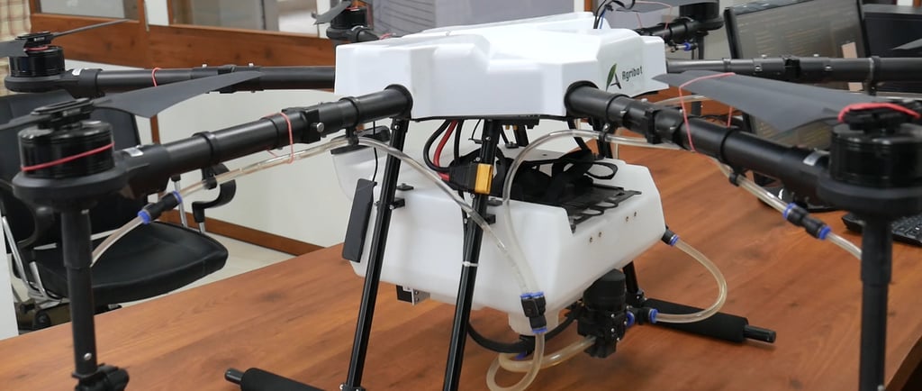
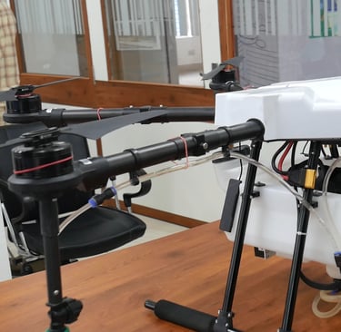
Drones have evolved far beyond being flying cameras or hobbyist toys. They’ve become indispensable tools across industries — from precision agriculture and infrastructure inspection to disaster management and defense. But here’s the catch: as drones got smarter, the data they produce exploded in size and complexity.
A single drone surveying a 100-acre site can generate gigabytes — sometimes terabytes — of high-resolution images, LiDAR scans, GPS coordinates, and sensor data in just a few hours. Multiply thatby an entire fleet, and you’re suddenly sitting on a mountain of raw information that’s impossible to handle manually.
This is where Artificial Intelligence (AI) and Cloud Computing swoop in like a perfectly timed drone strike — transforming chaotic data into actionable intelligence.
The Data Dilemma: Drones Don’t Just Fly, They Record Everything
Let’s start with the problem. Every drone mission generates several data streams simultaneously:
Visual data: Images and videos from RGB or thermal cameras.
Positional data: GPS coordinates and flight telemetry.
Sensor data: Readings from LiDAR, infrared, hyperspectral, and other sensors.
Now imagine manually sorting and analyzing thousands of images to detect cracks in a bridge or changes in crop health. It’s not just inefficient — it’s humanly impossible at scale.
The challenge isn’t just storage, but management — organizing, labeling, analyzing, and securing data while keeping it easily accessible. Traditional on-premise systems buckle under this load, and this is where AI and cloud infrastructure join forces.
Cloud Computing: The Invisible Backbone of Drone Intelligence
Think of cloud platforms as the central nervous system for drone operations. Instead of storing all that heavy data locally (and risking drive failures or limited capacity), drones can upload it directly to the cloud in real time or after missions.
Here’s what the cloud brings to the table:
Scalability: Need to store a few gigabytes today and a few terabytes tomorrow? No problem. Cloud platforms scale effortlessly, letting businesses expand drone operations without worrying about physical storage limits.
Accessibility: Data stored on the cloud can be accessed from anywhere — whether your analysis team is in New Delhi, your client is in Singapore, or your drone fleet is flying over the Indian Ocean. Real-time access means faster decision-making and smoother collaboration.
Security: Leading cloud providers (like AWS, Azure, and Google Cloud) employ high-grade encryption and access control protocols. In industries like defense or energy, where drone data can be sensitive, this is crucial.
Integration: Cloud APIs can seamlessly connect with AI models, analytics dashboards, GIS software, and even IoT systems. This makes the drone ecosystem fluid and interconnected — no more data silos.
Artificial Intelligence: Turning Raw Data into Smart Insights
Uploading data to the cloud solves storage issues — but understanding that data is where AI flexes its muscles. AI algorithms, especially machine learning (ML) and computer vision models, can analyze drone data faster and more accurately than any human team.
Here’s how:
1. Image Recognition and Object Detection: AI models can scan thousands of aerial images to identify features — whether it’s cracks on solar panels, missing roof tiles, or diseased crops. For instance:
In agriculture, AI can detect crop stress or pest infestation through color spectrum analysis.
In infrastructure, computer vision models detect structural damage with pixel-level precision.
In security, object recognition helps identify unauthorized vehicles or intrusions.
2. Predictive Analytics: AI doesn’t just describe what’s happening — it predicts what will happen. By analyzing trends and historical patterns, AI can forecast:
Equipment failures before they happen
Changes in terrain or vegetation
Water levels or flood risks
It’s like giving your drone data a crystal ball.
3. Automated Mapping and 3D Modeling: AI-driven photogrammetry software converts drone images into detailed 3D maps or digital twins. These models are used in urban planning, mining, and even archaeology. The AI improves accuracy by stitching together thousands of overlapping images and correcting distortions — work that would take humans days or weeks.
4. Real-Time Decision Making: With AI models deployed at the edge (on the drone itself), decisions can happen instantly — like identifying an obstacle during flight or detecting a person during a rescue operation. When paired with 5G connectivity and cloud sync, it creates a loop of real-time intelligence: drones collect → AI analyzes → cloud stores and shares → teams act.
Industry Use Cases: Where the Magic Happens
Agriculture: Cloud-connected AI platforms process multispectral imagery to detect nutrient deficiencies, irrigation issues, and pest infestations — optimizing yields while cutting waste.
Construction: AI and cloud integration generate 3D site models, track project progress, and detect deviations from design blueprints in real time. Project managers can access live dashboards from anywhere.
Disaster Management: Drones relay live imagery to cloud servers, where AI identifies survivors, maps flood zones, or assesses damage. Fast, data-backed decisions literally save lives.
Environmental Monitoring: AI models analyze cloud-stored drone footage to monitor deforestation, water quality, or wildlife populations. The insights are shared across teams globally via cloud networks — ensuring coordinated action.
Energy Sector: From solar farms to oil pipelines, drones inspect assets while AI detects anomalies. Cloud-based analytics help companies schedule maintenance before breakdowns occur.
The Future: Autonomous, Connected, and Cloud-Native
The next phase of drone evolution will be autonomous intelligence — drones that don’t just fly routes but make choices mid-air based on AI insights and cloud feedback.
Imagine fleets that coordinate automatically:
Drones recharging at smart stations
Sharing real-time maps via cloud sync
Adjusting flight paths to weather data fetched on the go
Updating central databases instantly
This isn’t sci-fi — it’s already unfolding in industrial ecosystems powered by AI, 5G, and edge-cloud synergy.
Challenges on the Horizon
Of course, it’s not all smooth flying.
AI-cloud integration in drone data management faces a few turbulence points:
Data privacy laws differ across countries.
Bandwidth limitations can slow real-time uploads in remote zones.
Training AI models requires huge labeled datasets and expert validation.
But as infrastructure improves and AI becomes more energy-efficient, these issues are being ironed out — fast.
The AI–Cloud Synergy: Smarter Together
AI and cloud don’t just coexist — they amplify each other.
The cloud provides the horsepower: scalable computing, vast storage, and seamless global access.
AI provides the brains: extracting insights, finding anomalies, and automating decision-making.
Together, they make drone operations lean, responsive, and self-improving.
Example: Infrastructure Inspection
Let’s say a power company uses drones to inspect 10,000 transmission towers. Here’s what happens:
Drones capture high-res images and telemetry data.
Data uploads automatically to the cloud.
AI models analyze images to detect rust, cracks, or vegetation encroachment.
Cloud dashboards visualize results, rank critical issues, and alert maintenance teams.
Result? What once took months now takes hours — with near-zero human error.
Final Thoughts: The Sky Isn’t the Limit Anymore
Drones gave us eyes in the sky. The cloud gave us reach beyond borders. AI gave us understanding.
Together, they’re not just managing data — they’re redefining how we see, map, and interact with the world below.
In a world drowning in information, drones powered by AI and cloud aren’t just flying — they’re thinking.
And that’s what truly makes them soar.
Ready to Harness AI-Powered Drone Intelligence?
At Kesowa, we’re building the future of data-driven drone operations. From smart aerial surveys to AI-backed analytics and cloud-based asset management, we help businesses transform drone data into strategic insights — faster, smarter, and greener.
Connect with Kesowa to explore how AI and Cloud can elevate your drone ecosystem to new heights.
Visit kesowa.com or reach out to our team to get started.
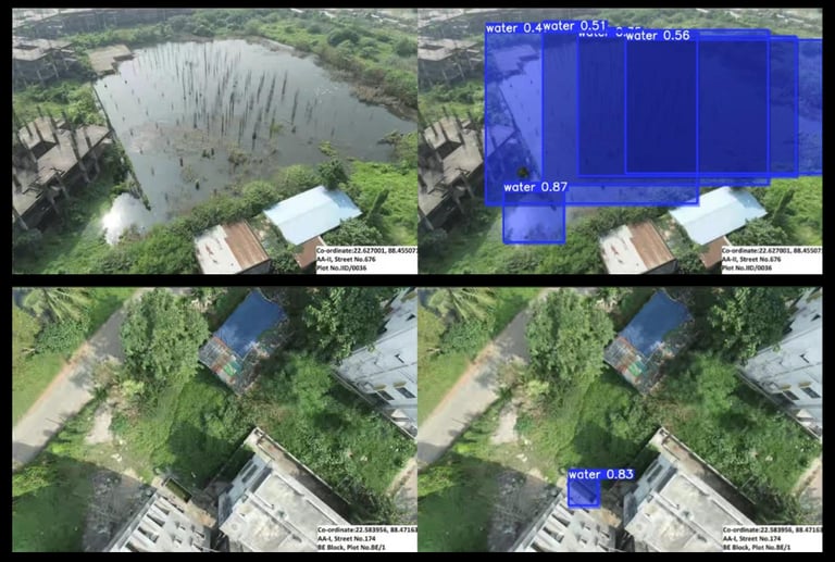
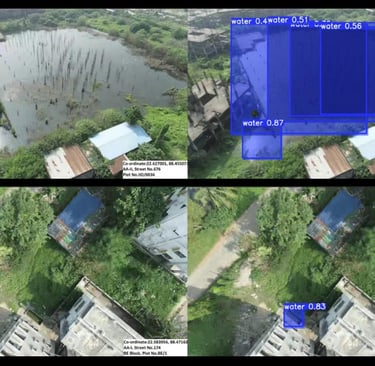


Photo by Mohammad Yasir


Helpful Links
Join Us Online
Want to learn more?
Copyright © Kesowa Infinite Ventures Private Limited
Subscribe to our newsletter for the latest features and updates.
By subscribing, you consent to our Privacy Policy and receive updates.