
Drone Data Call Centers: The Future of Infrastructure Monitoring in India
How Drones can help with Infrastructure Monitoring.
USE-CASETHOUGHT-PAPER
Rimashree
4/19/20254 min read
In today’s world where infrastructure needs to be smarter, faster, and safer, drones are no longer a futuristic concept – they’re a working reality.
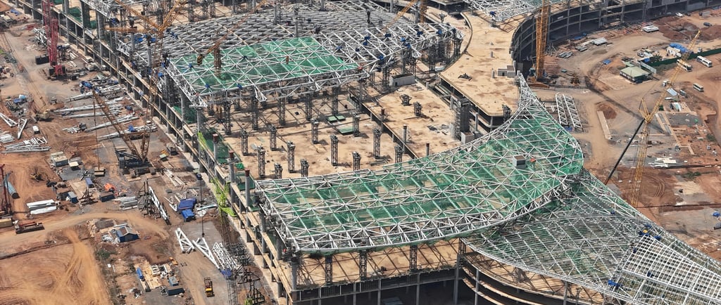
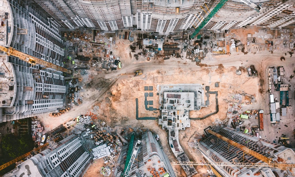
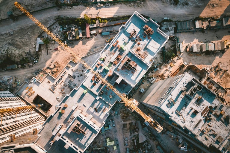
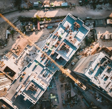
Imagine this: a 100 km highway is under construction, stretching across rugged terrain. Instead of dispatching engineers to physically inspect each segment, drones silently soar overhead, capturing terabytes of real time imagery, LiDAR scans, and heat signatures. Now imagine going one step further: real-time drone footage, AI powered analytics, and seamless project tracking – all coordinated from a centralized command center – a Drone Data Call Center – where it’s processed, analysed, and translated into real-time decisions.

What Is a Drone Data Call Center?
A Drone Data Call Center is a centralized digital hub where drone-captured data is received, processed, and distributed — like a virtual control tower for modern infrastructure projects.
Think of it as a mission control system for infrastructure: drones capture the visuals and measurements from the sky, and the call center processes this raw data into insights that project managers, engineers, and decision-makers can act on in real-time, sitting miles away.
In short, it connects the field to the boardroom - instantly.
How It Works: From Flight to Insight
Here’s how the ecosystem functions, step by step:
1. Requested – A call or digital ticket is logged for drone assistance.
2. Mission Creation – Operators create flight plans using Kesowa’s ARU platform.
3. Deployment of Drones - Equipped with sensors like LiDAR, RGB, thermal or multispectral cameras, drones are deployed to survey large areas with precision.
4. Data Collection - As drones fly, they collect high resolution visuals, spatial data and thermal patterns.
5. Processing & Analysis - Data is processed using tools like Agisoft, QGIS, and UGCS and converts it into easy-to-understand reports.
6. Reporting - Insights are relayed back to the requester or department — often in real time.
This smooth workflow slashes delays, improves accuracy, and boosts transparency across the board.

The Physical Side of the Future: Enter the Drone Port
If the Drone Data Call Center is the brain, the Drone Port is the backbone.
A Drone Port is a dedicated physical facility where drones are launched, landed, charged, maintained, and stored. It functions as a permanent base of operations for unmanned aerial systems (UAS), especially in industrial zones or large infrastructure sites. Think of it like an airport, but for autonomous drones.
Connection to Drone Data Call Center:
The synergy is powerful. Drone Ports act as the physical nodes in the aerial data network, enabling:
1. Continuous drone operations without manual intervention.
2. Real-time data transfer to the cloud, seamlessly feeding into the call center.
3. Scheduled and autonomous missions, even across multiple sites, managed remotely.
4. Improved uptime and faster redeployment of drone fleets.
In short, Drone Ports make persistent, reliable drone data collection possible — and Drone Data Call Centers make that data useful.
Why Infrastructure Needs Drone Data Call Centers Now
Modern cities are expanding rapidly, but the tools used to monitor, plan, and maintain this growth haven’t kept pace. City managers and infrastructure teams face multiple operational roadblocks:
1. Lack of real-time, reliable data on vital urban assets like roads, utilities, water bodies, and waste systems
2. Delayed responses to issues such as encroachments, illegal dumping, waterlogging, or construction violations
3. Fragmented and siloed data sources, leading to disjointed planning and misaligned execution
4. Manual surveys that are time-consuming, costly, and often riddled with inaccuracies
5. Inability to quickly access or act on geospatial data, slowing down everything from maintenance to expansion
This is where Drone Data Call Centers offer a transformative solution.
They centralize operations, digitize data collection, and make infrastructure management smarter and more responsive. Here’s how they change the game:
1. Real Time Progress Monitoring: Stakeholders get immediate visibility into project status, milestone tracking, and potential delays.
2. Proactive Issue Detection: Spot structural irregularities, thermal anomalies, and land misuse before they turn into expensive problems.
3. Smarter City Planning: Generate accurate orthophotos and 3D models instantly for more informed layout decisions.
4. Improved Safety: High-risk inspections are done remotely by drones, drastically reducing field staff exposure.
5. Transparent Reporting: Every mission is logged and accessible, ensuring accountability with regulators, partners, and communities.
Why the Country Is Ready – And Already Moving
With national initiatives like PM Gati Shakti, Digital India, and Smart Cities Mission, India is accelerating infrastructure like never before. With the scale of development expanding rapidly, traditional site management techniques are struggling to keep up.
This is where drone-powered control centers can offer a strategic edge. Startups, government departments, and tech-enabled EPC companies are now setting up command centers that can manage dozens of sites remotely — saving time, money, and effort. These permanent drone bases will support continuous aerial monitoring, making real-time data a standard, not a luxury.
Final Take
The combination of Drone Data Call Centers and Drone Ports is not just a futuristic idea — it’s a tested, operational model that’s actively transforming how cities and infrastructure teams work.
By building this system into large-scale projects, we move from reactive to proactive infrastructure management — where every square foot of progress is mapped, monitored, and measured.
The future of infrastructure isn’t just being built — it’s being flown, mapped, and managed from the sky.
Blog Post by Rimashree
Images from https://www.pexels.com/photo/under-bridge-site-with-heavy-machine-4254898/, https://www.pexels.com/photo/light-city-cars-road-9716233/, https://www.pexels.com/photo/aerial-view-of-construction-site-in-d-ng-nai-30810999/, https://www.pexels.com/photo/construction-site-along-the-road-2833686/, https://unsplash.com/photos/aerial-photography-of-white-high-rise-concrete-building-Wv2U24G2F78, https://unsplash.com/photos/aerial-view-photography-of-vehicles-and-buildings-during-daytime-0-no6ywKMPY


Helpful Links
Join Us Online
Want to learn more?
Copyright © Kesowa Infinite Ventures Private Limited
Subscribe to our newsletter for the latest features and updates.
By subscribing, you consent to our Privacy Policy and receive updates.